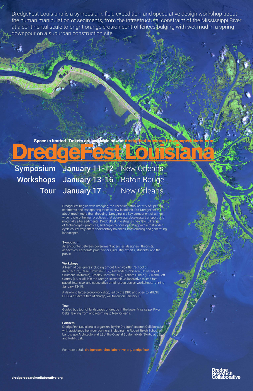
DredgeFest Louisiana
I spent one of the first few weeks of 2014 in the fantastic company of what I’m affectionately calling “sediment nerds.” From January 11th to the 17th, we converged on New Orleans, Baton Rouge, and points in between for a two-day symposium, film screening, mini-tour, series of student workshops, and a concluding second tour. It was exhausting and fascinating.
Yes. Sediment. Fascinating.
Allow me to explain.
The Dredge Research Collaborative (or DRC) is a crew of (mostly) landscape architecture/design folks who’ve been struck with a genius idea. Namely, “dredge,” the constellation of activities associated with the human manipulation of sediments, offers an analytical category for understanding the Anthropocene that yields all sorts of cool, quirky, revelatory stuff. Dredge is grounded in the material world—it’s literally about moving dirt around—but it also suggests an endless array of more abstract ideas about the permeable boundaries between nature and society. Dredge is where human and geologic timescales collide and serves as a great metaphor for the Sisyphean (and profoundly ironic) task of controlling nature, with all of its unintended consequences.
DredgeFest Louisiana was the second event curated by the DRC. The first DredgeFest took place in New York City in September of 2012 and entailed a far less ambitious schedule: a half-day symposium and a boat tour. Tim Maly (a member of the DRC) wrote about that first DredgeFest for Urban Omnibus. If I haven’t yet convinced you that sediment is, in fact, cool, then Maly’s piece surely will. DredgeFest Louisiana, by comparison, was a massive sophomore effort.
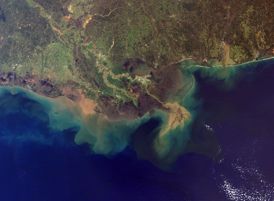
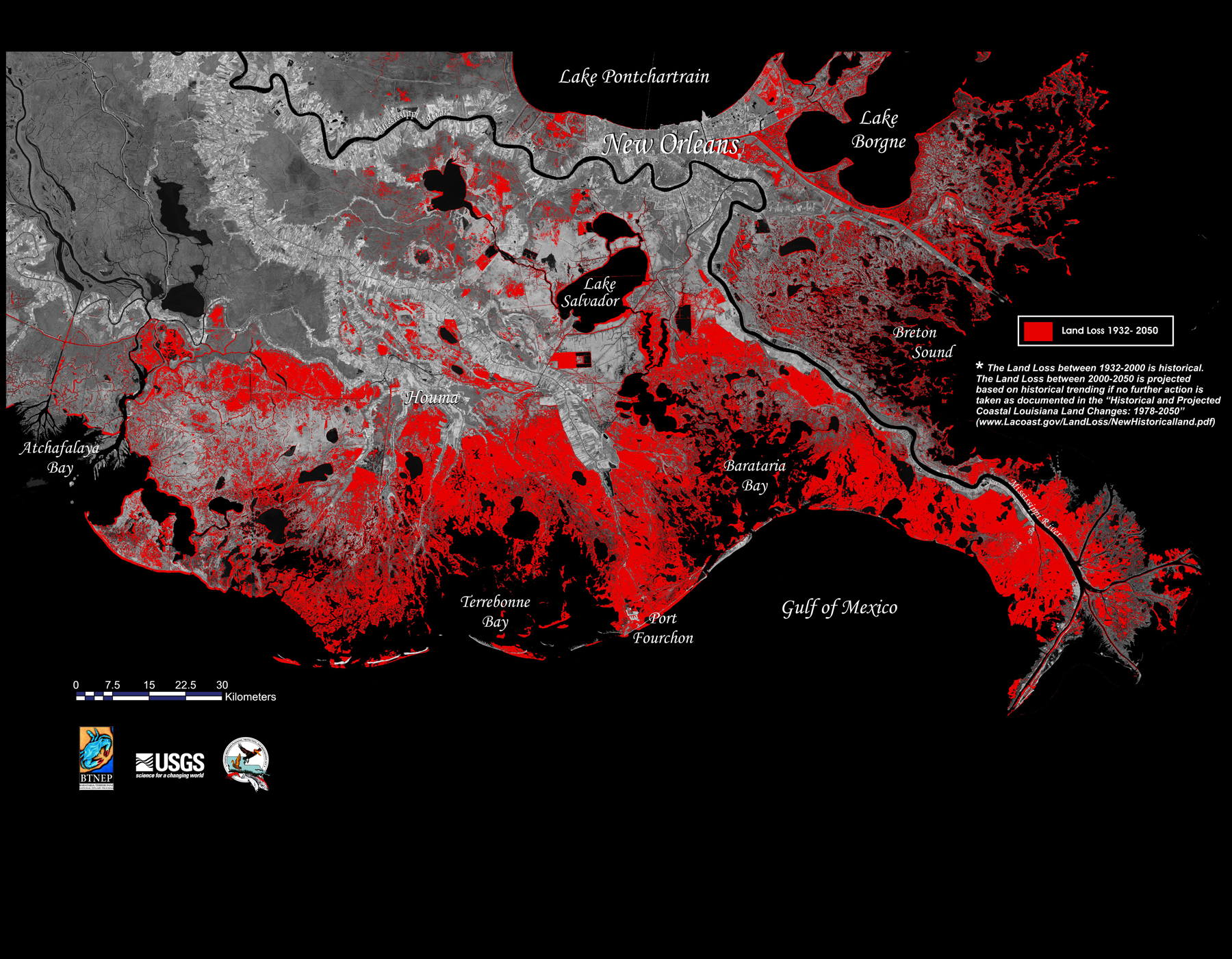
Why Louisiana? Well, there are few (if any) other places in North America in which sedimentary geology is more profoundly felt as part of daily life. As I’ve recounted elsewhere on this blog (here and here), southern Louisiana was built up entirely from about 8,000 years of sediments deposited by the Mississippi River.

For the last few hundred years, however, fewer and fewer of those sediments have found their way on to the landscape. Levees and other major infrastructural interventions aimed at taming the environmental variability of a major river delta have starved the region of its alluvial lifeblood. Meanwhile, we humans have also been hard at work accelerating geological rates of subsidence and erosion in the delta through draining and developing wetlands, dredging canals, and laying pipelines. Basically, southern Louisiana is simultaneously sinking and eroding into the Gulf. Recent projections of as much as between one and two meters of sea-level rise by the end of the century dramatically compound the whole disaster. After all, like other river deltas, the region has hardly any elevation to begin with.
Like I said, dredge gets you into the Anthropocene in all sorts of ways.
The Symposium
On Saturday I arrived bleary-eyed (hey, it’s New Orleans) at Loyola University, where the DRC had scheduled a two-day series of seven sessions, plus a gorgeous poster exhibit. You can peruse the symposium schedule for yourself, but let me flag a few highlights from the second day in particular.
Matt Coolidge of the always wonderful Center for Land Use Interpretation gave a tour of the Gulf Coast’s salt domes. These odd little geological features played huge roles in the history of Gulf Coast oil exploration and today serve not only as sites of oil and gas extraction, but also as storage facilities for the nation’s Strategic Petroleum Reserve.
They’re often recognizable in aerial photos because of the circular patterns of natural-resource development that emerge around them. More spectacularly (and tragically), they also get implicated in some pretty nasty disasters, including both the Lake Peigneur collapse (hokey History Channel segment embedded below) and the ongoing nightmare at Bayou Corne, Louisiana.
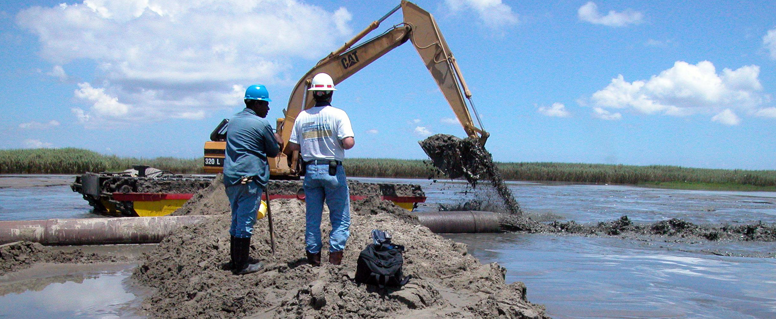
Also in the realm of distinctly infrastructural landforms was Charlie Hailey’s presentation on spoil islands, those artificial archipelagos created from spoil (i.e., disposed dredge material). Hailey drew largely from his book on the subject, which serves as a gorgeous, thoughtful meditation on the intersections of nature and culture that manifest as infrastructure. It’s also a great piece for thinking through the ways we define value, waste, and “matter out of place.” Spoil sediments dredged up from shipping channels or from dam reservoirs is, after all, a valuable resource in Louisiana’s sediment-starved coastal wetlands.
While there are hundreds of both ongoing and proposed coastal wetland restoration projects in Louisiana that depend on the “beneficial use” of dredged sediments, they all take place at pretty large scales. We’re talking about massive dredgers, pipes, and other heavy equipment. Karen Westphal of the Louisiana Audobon Society, in contrast, told us about her micro-restoration work using the Society’s custom-built mini dredger, the John James. Given many landowners work at small scales and either can’t wait or don’t want to wait for state and federal wetland restoration grants, the Audobon Society created a mobile, low-cost resource for more immediate use.
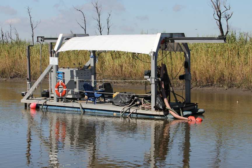
Westphal described her two years of toiling over pilot restoration projects aboard the John James with love, enthusiasm, and a keen awareness of the plants, birds, and other organisms that took part in her labors. In fact, I can only describe her intimate, deeply thoughtful work at land-building as a form of gardening. You can actually follow the restoration adventures of the John James on a blog run by Westphal.
In a similar realm of cool, low-cost custom technology, Scott Eustis and Becki Chall presented on their Public Lab work on the Gulf Coast. Public Lab is an open-source community that develops low-cost tools for citizen science and environmental monitoring. Some of their DIY kits include spectrometers (!) and balloon/kite-mapping tools. Eustis and Chall described recent work using kites and balloons to map both land loss and wetland restoration as well as monitor petrochemical malfeasance, including ongoing pollution from BP’s Deepwater Horizon oil spill.
The Screening
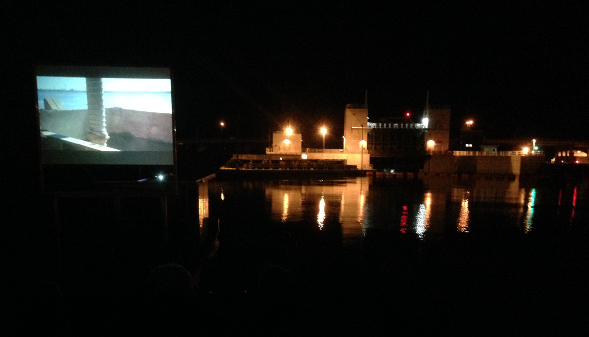
The night before all of these talks we’d been treated to an advance screening of Alex Chohlas-Wood and Ben Mendehlson’s The Fluid and the Solid. The choice of venue was almost impossibly ideal for a film about sediment, watery places, and the Anthropocene. Matt Coolidge had anchored the Center for Land Use Interpretation’s floating Tex Hex Unit at the northern end of the New Orleans Industrial Canal. Floating just a few hundred yards from the recently completed Seabrook Floodgate, the Tex Hex, outfitted with a screen and audio system, offered the perfect DredgeFest cinematic experience. Alex and Ben’s film is still in progress, but watch out for it at film festivals sometime soon—it’s full of vignettes about the sedimentary entanglements of environment and society, including some fine moments with stratigrapher and Anthropocene guru Jan Zalasiewicz.
The Workshops
Once the symposium came to a close, a bunch of us hustled up to Baton Rouge for a four-day series of DredgeFest student workshops, hosted by LSU’s Robert Reich School of Landscape Architecture.
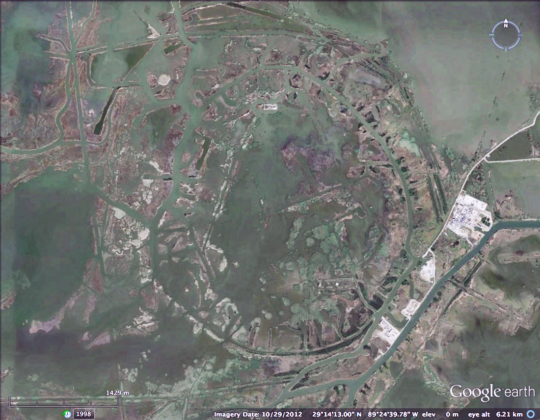
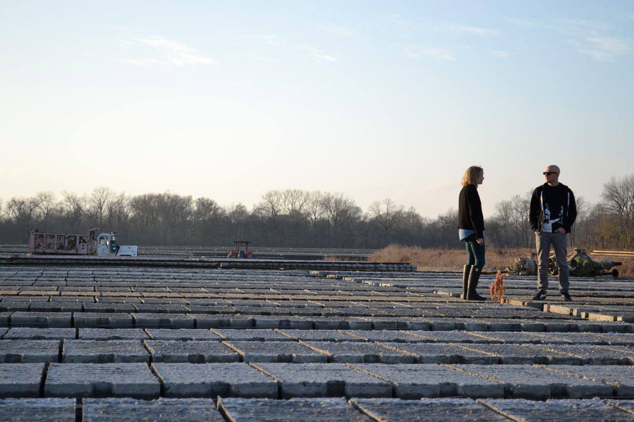
On our first day, we headed out for a workshop-framing mini-tour, which included a pilgrimage to Old River Control (immortalized by John McPhee) and a stroll around a curious site known as the St. Francisville Casting Fields. Rob Holmes, DRC co-founder and Mammoth blogger, first spotted the casting fields while perusing Google Earth. He’d found an enormous, off-white, striped polygon adjacent to the Mississippi River and, in trying to sort out what the hell it actually was, turned up a fascinating story.
Once the actual workshops started I was a little out of my element, not being a landscape-architecture guy. Nonetheless, it was great to watch an entirely different pedagogical process unfold. Three workshop tracks examined the problem of coastal land loss in Louisiana at the watershed, landform, and super-local scale.
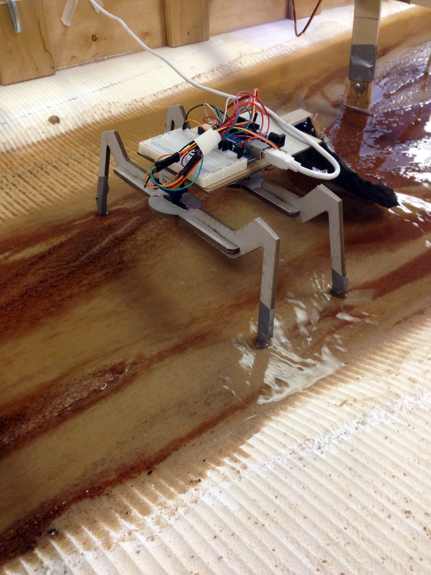
Plus there was a sediment table (see the timelapse, below), courtesy of Bradley Cantrell‘s robotics-meets-landscape-architecture lab. Oh, and a robot crawfish, of course.
The Tour
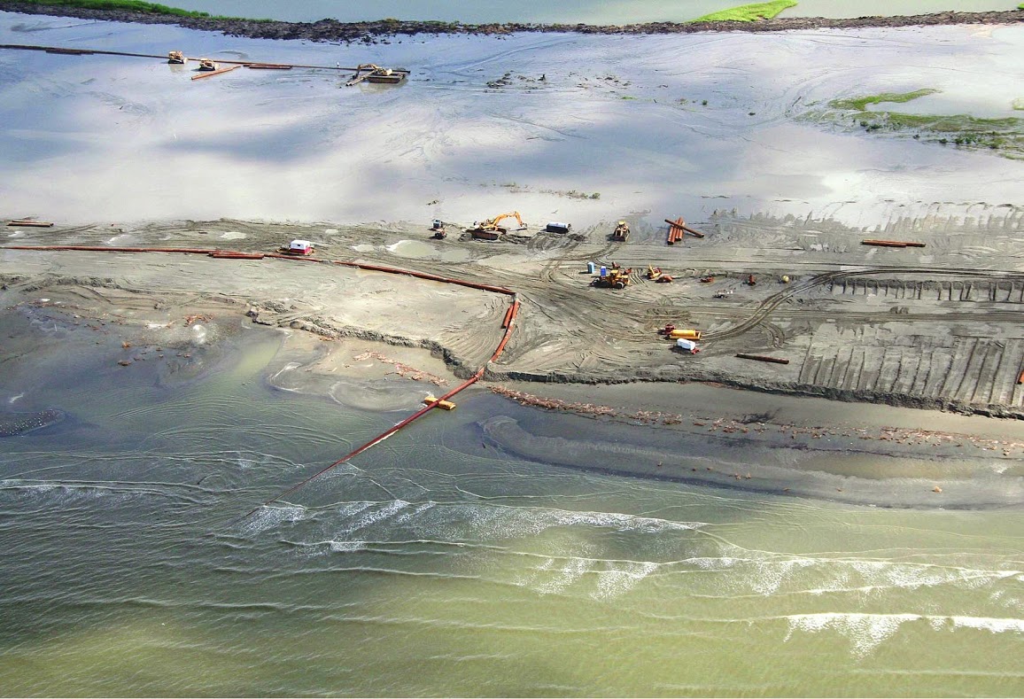
This exhausting, enthralling week of hanging out with my fellow sediment nerds concluded with a four-stop tour led by Scott Eustis of the Gulf Restoration Network and Public Lab: Gulf Coast. Kicking off at a micro-dredged wetland-restoration site, we soon headed to the Davis Pond Diversion, just downstream from a “blue hole” left by the catastrophic Davis Crevasse of 1884.

Completed in 2002, the diversion was built to introduce freshwater from the Mississippi River into wetlands affected by saltwater intrusion. As a secondary benefit, water passing through the diversion also deposits some river sediments back on the landscape. But since it wasn’t designed as a sediment diversion, the land-building that this structure can facilitate is pretty limited.
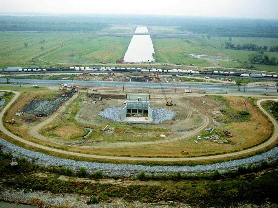
Capable of diverting a maximum of 11,000 cfs (cubic feet/second) from the Mississippi, the gates are actually tiny compared to some of the sediment diversions proposed in the 2012 Coastal Master Plan for Louisiana. In that document you’ll find structures capable of diverting up to 250,000 cfs of sediment-laden Mississippi water for the purposes of long-term land re-building.
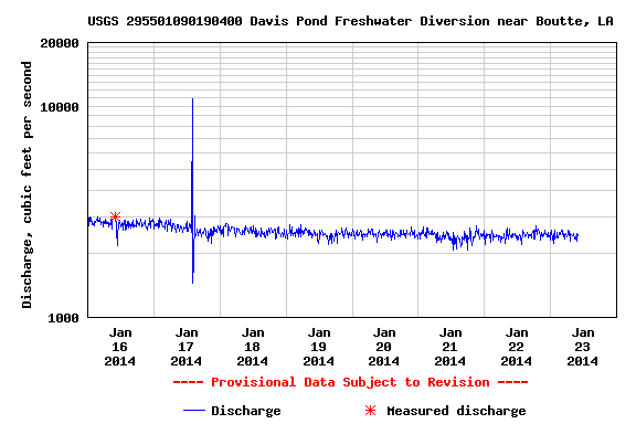
Now, flow rates in cubic feet per second are pretty abstract things. Even when you’re standing on the banks of the Mississippi watching all that water drift by, it’s still hard to really sense what those hundreds of thousands of cfs actually feel like. Thanks to the DRC’s organizing efforts, however, our group got a little taste of the forces involved when huge masses of water are moving through a channel.
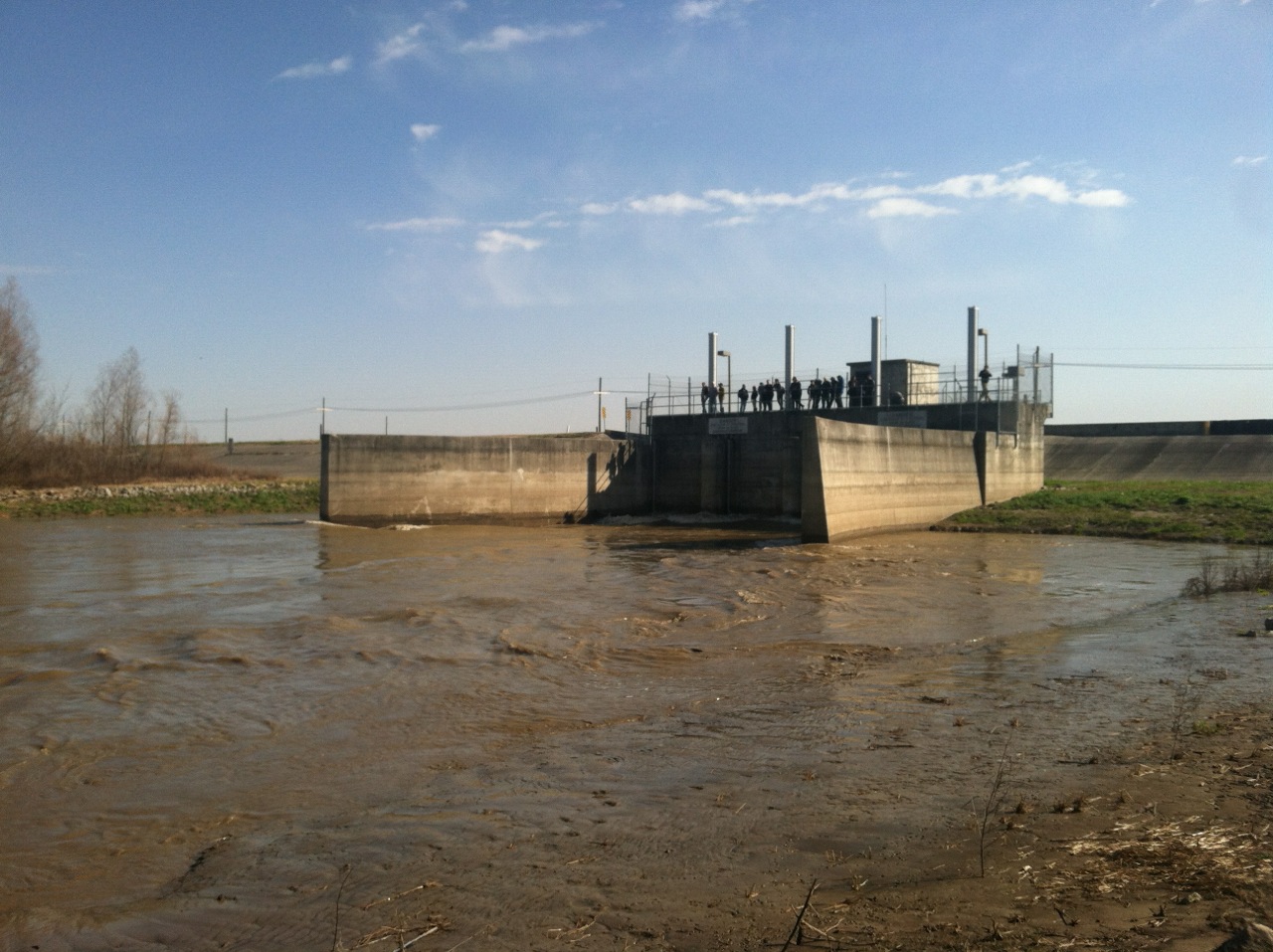
Greeted at Davis Pond by ecologist Chuck Villarrubia and two engineers, we got to stand atop the diversion as it was opened up from 0 cfs (our hosts wanted to maximize the experience) to a little over 10,000 cfs.
Historical ecologist Josh Lewis captured a good chunk of the experience and made a great little film out of the whole thing.
What might not come through from Josh’s short film was the thundering noise and shuddering vibration running through the diversion. As those gates slowly opened, large piece of driftwood started buckling and snapping against the current while all the other flotsam and jetsam that had accumulated around the diversion got quickly sucked into the wetlands beyond. When you consider the size of the Davis Pond Diversion and the forces acting on it even shy of full capacity, it gives some sense of how enormous and powerful a 250,000 cfs diversion will actually be. It also suggests just how much further industrialization of Louisiana’s deltaic plain needs to take place in order to save it.
What’s at stake in southern Louisiana’s sinking, eroding landscape is more than just the ecological devastation associated with disappearing wetlands. Thousands upon thousands of livelihoods depend on the integrity of coastal Louisiana, from commercial fisheries, to the oil and gas industry (which, ironically, has contributed considerably to the problem), to shipping and navigation. All of which is to say nothing of the habitability of New Orleans and other cities in the delta. I should also say, this isn’t just a Louisiana crisis, it’s a national crisis. For better or worse, all of us depend on the delta in some way. The enormous economic footprint of the Port of New Orleans and Mississippi River shipping, the fossil fuels extracted off the Louisiana coast, and the fisheries caught in its waters all have a way of penetrating into the lives of most North Americans.
If you want to see the collision of sedimentary, geologic time with human lives and livelihoods, head to Louisiana.
And definitely don’t miss the next DredgeFest.